Getting the Latest App Status Information. The best place for current app status or data download issues with the USGS is the iFeltThat News section inside the app. From any region list view, tap on the gear icon at the upper right corner; then tap on “iFeltThat News”.
Personalized Support. I provide you with a quick and personal response to your questions or comments when you send me an email message. You can do that from inside the app (via the gear icon and “Help” menu choice) or by sending a message to the address shown above. The more descriptive you can be with your concern, the more quickly we can reach a resolution. Please note that the App Store does not forward review comments or your address to app authors, so we can’t respond to you when you post issues in app reviews. Since you paid good money for this app, you might as well send an email to get actual help that can resolve your issue.
From the Archive. If you experience a crash upon launching the app, here are some things to try:
-
•Unlock your device and double-press the device’s Home button to view recently-run apps (they appear in a horizontally-scrolling panel showing app icons and small screenshots).
-
•Scroll to locate iFeltThat.
-
•Swipe the screenshot image upward, all the way to the top until the app disappears from the scrollable panel. This action “force quits” the app without deleting it or your settings.
-
•Press the device’s Home button twice to get back to the usual launch screen, and tap the iFeltThat icon to relaunch the app.
-
•If the above steps don’t work, (and as a last resort), delete the app from your device and reinstall from the App Store. The Store remembers your purchase and won’t charge you again for subsequent downloads.

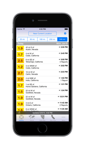
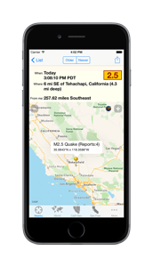
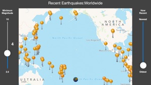
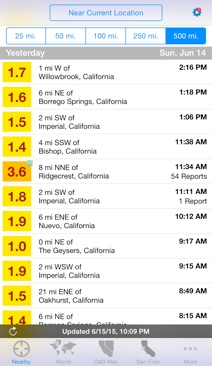
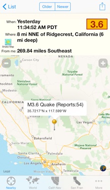
 FeltThat Earthquake version 2.5 is the premier earthquake information reader for your iPhone or iPod touch. This app makes it easy to focus on earthquake events that are most important to you: